
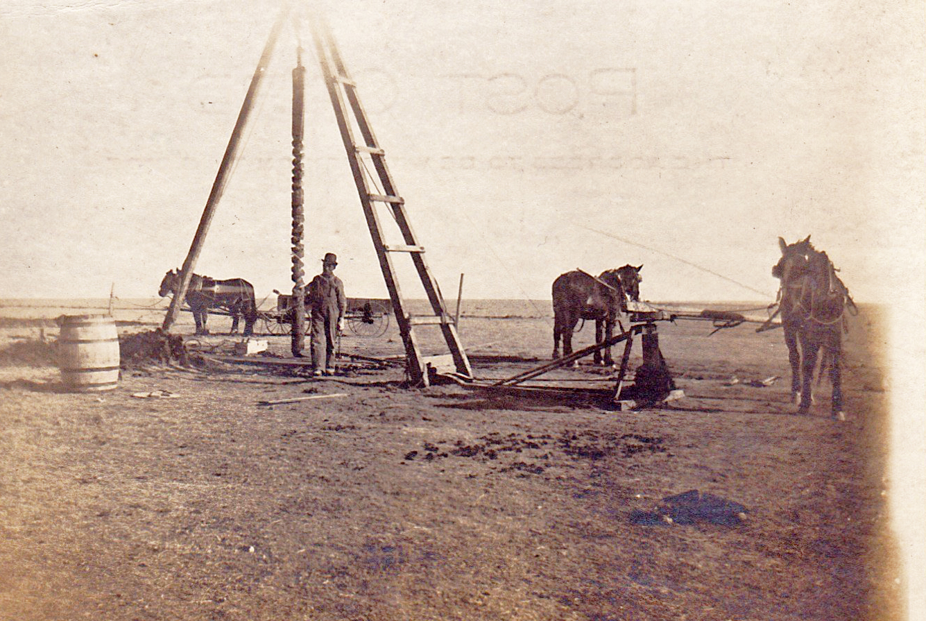
Bert Bowers, the sender of this card dated June 13, 1908, is writing to Barney McCaskey in Ogden, Iowa. He writes: “Hello Barney, How are you getting along. We are all O.K. Working all the time. We are having some nice rains now. Crops look good. Will write more next time. Hoping to hear from you soon. Good Bye, Bert Bowers.” In an added note he writes: “Do you recognize this place. That hat does look good don’t it.”
Cheyenne Wells is the seat of Cheyenne County and, with about 800 residents, the county’s most populous town. It sits southeast of Limon, about 20 miles west of the Colorado-Kansas state line. Incorporated in 1890, Cheyenne Wells is named for two things: 1) The Cheyenne tribe, which lived and hunted buffalo in the area throughout the nineteenth century; and 2) The well dug in 1860 by Lieutenant Julian Fitch, an Army surveyor, who was seeking to map the Smoky Hill Trail, named for the Smoky Hill River, in 1860. (The well was located about five miles north of the present-day town site.) The river was named for the region of north-central Kansas through which it flows.
The Smoky Hill Trail was one of four main routes taking white immigrants across the Great Plains to the Rocky Mountains and was presumed to be the most direct. But the lack of knowledge on the part of the trail’s boosters about the true course of the Smoky Hill River led to disaster for many. To quote from the Colorado Encyclopedia: “Boosters from towns vying to be the main starting point of the trail claimed that the largely uncharted Smoky Hill River would guide settlers all or most of the way to the Rocky Mountains. But immigrants who followed the river across Kansas found that the Smoky Hill turned to sand just east of the present-day Colorado border. They were left to find their way northwest across a disorientating landscape of sprawling creeks, rolling hills, and vast open stretches. This western portion of the Smoky Hill route included present-day Cheyenne County and became known as the “Starvation Trail” on account of the many immigrants who became lost and starved to death.”
The Bert Bowers in this photo and a Bert A. Bowers born in Castana, Iowa, in 1879 could be the same person. In October of 1906, Bert A. Bowers married Mathilda Dockweiler in Castana, and records show they eventually went on to have six sons and a daughter. The 1910 Census reported that they were farming outside of Stratton, Colorado, which is about 33 miles north and a little west of Cheyenne Wells. By 1920 they were living in Bon Homme County in South Dakota, where they farmed until their retirement around 1951. Bert died in Scotland, South Dakota, on New Year’s Day, 1967, at the age of 87. Mathilda died in Yankton, South Dakota, at the grand old age of 97.
REFERENCES:
- “Argus Leader” (Sioux Falls, SD), dated January 4, 1967, and April 13, 1984 (www.newspapers.com)
- Colorado Encyclopedia at https://coloradoencyclopedia.org/article/cheyenne-county
- Disween.com at https://disween.com/stratton-co-us/cheyenne-wells-co-us
- Stone/Sharp/Leise/Romm/Landberg/Anderson family tree (www.ancestry.com)
- Wikipedia at https://en.wikipedia.org/wiki/Smoky_Hill_River
- World Population Review at http://worldpopulationreview.com/us-cities/cheyenne-wells-co-population/